Today we left Kanab, UT and drove to the north rim of the Grand Canyon. then we drove a couple of hundred miles around to the south rim of the Grand Canyon. It was really windy...40+ mph...and there was a lot of dust in the air.
Sunday, May 23, 2010
Day 11
Today we drove to Bryce Canyon and then onward to Kanab, UT. Brice canyon was pretty but crowded...probably a sign of things to come as we move on to the Grand Canyon tomorrow.
Saturday, May 22, 2010
layover day
We stayed over a day in Torrey, Washed the car, washed clothes, took a drive down to Escalante on Scenic Rt 12 and back. We'll drive down there again tomorrow on the way out of here. Lot's of wind and blowing dust. the car was all dirty again in no time.
Friday, May 21, 2010
Moab to Torrey, UT.
We left Moab and drove northeast along the Colorado River for about 40 miles until we reached Interstate 70. Then we headed west towards green River, UT.
Not much out there along I-70 in Utah. Telephone Poles and railroad tracks.
This is Downtown Green River, UT. It reminds me a lot of Van Horn, TX. We found a park and had a picnic lunch.
This is called the San Rafael Swell. It's just this really big really long upheaval of rock that runs for a long distance north and south. I'd read about it but not seen photos. it wasn't difficult to figure out we were there.
Getting near to Torrey. they have Oreo Cows in the field here.
Capital Reef National Park just outside Torrey, UT. we're staying a couple of nights in Torrey so we can rest up, do laundry, wash and clean out the car, and generally regroup.
Wednesday, May 19, 2010
Day 8 Moab, UT
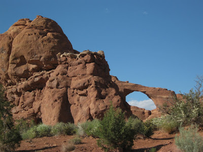
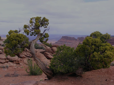
Today we drove to Moab, and went to the northern part of Canyonlands National Park and to Arches National Park. Spending the night in Moab. There was lots to look at today, and my eyes are tired, so this is going to be short. There are a lot of people in these parks. Parts of Arches have traffic jams. I can't imagine how crowded it gets in the summertime when families are on vacation. Wouldn't want to be here then. Moab is a kinda neat little town though. The colorado River runs through the north end of town. Just downstream in Canyonlands National Park the Colorado and the Green rivers become one big river. Moab has lots of tourist-based businesses because there isn't any other way to make a living here that I can see except maybe mining of some sort. They used to mine Uranium here but I don't think they do that anymore. We had a real meal in a real restaurant this evening. We might even do that again tomorrow...it's that or restock on groceries. All for now.
Tuesday, May 18, 2010
Day 7
We started day 7 by driving to Canyonlands National Park - Needles Overlook, where it was really windy - it blew over my tripod with my camera on it...the camera lived....then it was back to Monticello for lunch. We took a different way back that went up and over a mountain where the rain that we had been driving through off and on turned to snow. Next, it turned to sleet for about a mile, then we were out of it and down the other side. That's where we saw all the deer. Along this route we passed Newspaper rock, where people have been drawing on the wall for over 1000 years now, and some still are even though it;s against the law now. I guess graffiti has been around a long time.
Later we drove south to Hovenweep National Monument and hiked around the ruins there between rainstorms. Well, mostly between rainstorms...we got a few sprinkles but it wasn't too bad. We finished up the day driving back to the hotel where we ate what was in our doggy bag for dinner, and that was all for today.

Later we drove south to Hovenweep National Monument and hiked around the ruins there between rainstorms. Well, mostly between rainstorms...we got a few sprinkles but it wasn't too bad. We finished up the day driving back to the hotel where we ate what was in our doggy bag for dinner, and that was all for today.

Monday, May 17, 2010
Day 6 - to Monticello, UT
Today we drove north into Utah. We saw the good side of Monument Valley. Much prettier when approaching from North to South.
This is called the Moki Dugway. It's a road that switchbacks up the mesa for about 1200 ft. Seems higher to me.
Caught him napping and grabbed a close-up.
Me in a Kiva.
Roadside bluebonnets at 7000 ft high.
Sally on top of the mesa. She's not really close to the edge, mom.
Sunday, May 16, 2010
Day 5 gallup NM to Kayenta, AZ
Window Rock, NM. That hole is 130 ft. in diameter.
Hubbell Trading Post - founded in the 1870's
Canyon De Chelley - that little castle-looking thing is actually about 800 ft down and is probably at least 100 ft. tall. Scale is different out here.
Monument Valley. Utah, not Arizona like I'd always believed. Pretty from afar. get up close and there's buildings and shacks and moblile homes and all kinds of stuff that sorta spoils the view. You can see some of it on the far left of this photo.
Saturday, May 15, 2010
by the way,,,
if you click on any of the pictures you will get a bigger view of the same picture....Just FYI
then onward to Chaco Culture
These ruins were originally built between 1200 years ago and about 800 years ago. I guess they've help up pretty well. Figured Joe S. would like the close-up of the stonework. I'm not sure it will show up very good though.
Drove to shiprock, NM
Shiprock is this great big volcanic plug. This was the molten center of the volcano but the rest of the volcano eroded away sometime over the ages and this hard rock is what's left. Next picture shows volcanic dikes, where motlen magma pushed up through cracks in the earth, then the earth eroded away and left these walls. See, I did learn something taking geology in college.
Today we drove to Gallup, NM via Shiprock and Chaco Culture
We left Cortez, CO this morning...spotted 4 more old Thunderbirds in Cortez, along with an old Caddy with the big fins. We've seen dozens of old cars on this trip that you'd never find back home.
.JPG)
Subscribe to:
Posts (Atom)


.JPG)
.JPG)


.JPG)
.JPG)


.JPG)


.JPG)

.JPG)